Phongsaly District (Muang Phôngsali)
Phongsali or Phongsaly (ຜົ້ງສາລີ) is the capital of Phongsaly Province, Laos. It is the northernmost provincial capital in Laos, opposite Attapeu in the south. The town has about 8,000 inhabitants. It lies at approximately 1,430 meters elevation on the slopes of Mount Phu Fa (1,625 meters). Phongsali has summer temperatures around 25-30 °C, with frequent rain. In winter, from November to March, it is cool and mostly sunny, with daytime temperatures between 10-18 °C.
In the centre of the town are houses built in Yunnanese style with ornate wooden fronts. This is quite rare as the preserved city was not destroyed like other cities in northern Laos during the Vietnam War by bombing.
A 400 year-old tea plantation is about 18 kilometers away in the village of Ban Komaen, which according to some tea experts has some of the oldest tea trees in the world. The large root system of the old trees extends deep into the mineral-rich soil and gives the "Phongsali tea" a distinctive aroma and taste.
Map - Phongsaly District (Muang Phôngsali)
Map
Country - Laos
 |
 |
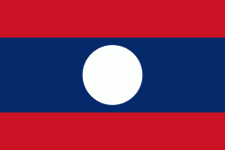
| Flag of Laos | |
Present-day Laos traces its historic and cultural identity to Lan Xang, which existed from the 13th century to the 18th century as one of the largest kingdoms in Southeast Asia. Because of its central geographical location in Southeast Asia, the kingdom became a hub for overland trade and became wealthy economically and culturally. After a period of internal conflict, Lan Xang broke into three separate kingdoms: Luang Phrabang, Vientiane and Champasak. In 1893, the three territories came under a French protectorate and were united to form what is now known as Laos. It briefly gained independence in 1945 after Japanese occupation but was re-colonised by France until it won autonomy in 1949. Laos became independent in 1953, with a constitutional monarchy under Sisavang Vong. A post-independence civil war began, which saw the communist resistance, supported by the Soviet Union, fight against the monarchy that later came under influence of military regimes supported by the United States. After the Vietnam War ended in 1975, the communist Pathet Lao came to power, ending the civil war. Laos was then dependent on military and economic aid from the Soviet Union until its dissolution in 1991.
Currency / Language
| ISO | Currency | Symbol | Significant figures |
|---|---|---|---|
| LAK | Lao kip | â‚ | 2 |
| ISO | Language |
|---|---|
| EN | English language |
| FR | French language |
| LO | Lao language |


